
The Digital Twin of the UNESCO World Heritage Site Hallstatt–Dachstein/Salzkammergut: A Comprehensive Project for the Documentation and Management of the Cultural Landscape Registry
In spring 2025, the World Heritage Management, in close cooperation with the municipality of Hallstatt, initiated a pioneering collaboration with RIEGL. The goal is to create a digital twin of the UNESCO World Heritage Site, expanding and refining the existing digital cultural landscape registry. This comprehensive research project serves to capture and document the World Heritage Site in detail.
For the World Heritage Management, this represents an important step in the documentation and monitoring of the site.
For RIEGL, the focus of this project is on demonstrating their advanced LiDAR technology and products in diverse and challenging environments, as well as at different scales. After data acquisition, the collected information will be made available to the World Heritage Management and will be regularly updated as part of the continuous site monitoring.
Applied Methods
The data collection employs state-of-the-art techniques:
- Airborne Bathymetric Laser Scanning (BLS): This technology allows for the recording of underwater areas, which is particularly important for documenting water-adjacent elements of the World Heritage Site.
- Terrestrial Laser Scanning (TLS): Ground-based laser scanners capture highly precise 3D data of objects and terrain features.
- Combination of ALS (Airborne Laser Scanning) and TLS: Integrating airborne and terrestrial scans ensures a comprehensive and detailed recording of the entire World Heritage area, including topographical features and built structures.
Preliminary results of this project can already be viewed on RIEGL’s project page.
Background and Future Developments
This current initiative builds upon previous work and future plans:
- Extended Laser Scanning Campaign (End of 2024): Since late 2024, a collaboration with RIEGL has focused on key areas such as the Seeklause in Steeg, the entire municipality of Hallstatt, and the archaeological excavations of the Natural History Museum (NHM). The World Heritage Association holds full usage rights to these data, including underwater areas. Further models from this campaign are expected in fall 2025.
- Photogrammetric Model and Cultural Landscape Inventory (TU Vienna): In parallel with the laser scans, students from TU Vienna are creating a photogrammetric model of the region. These students have previously collected extensive data for a cultural landscape inventory in the Dachstein-Hallstatt/Salzkammergut World Heritage region. Presentation of the collected data is planned for early 2026. The results are crucial for site management, local municipalities, and tourism, as they provide a detailed foundation for planning and conservation measures.
- Digital Cultural Landscape Inventory: All collected data, from both laser scans and photogrammetric surveys, will be integrated into a comprehensive cultural landscape inventory. This inventory georeferences key attributes, unique features, and the structural condition of the World Heritage Site. These valuable data will be publicly accessible from 2026 via the World Heritage Management website.
- “Future Lab & World Heritage Center” (CultureEXPO 2027): Plans are underway for a “Future Lab & World Heritage Center” as part of CultureEXPO 2027. This center aims to make digitalization tangible and experiential, featuring innovative applications such as virtual reality, 3D printing, and artificial intelligence to present and interpret the World Heritage Site in interactive and engaging ways.

Punkte der Vermessung durch Riegl
RIEGL Data Acquisition – Summer 2025
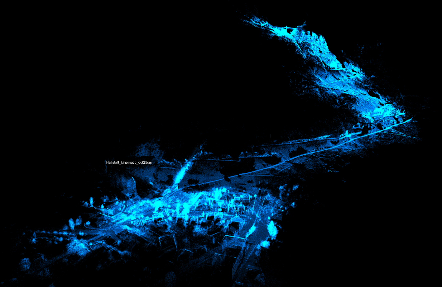
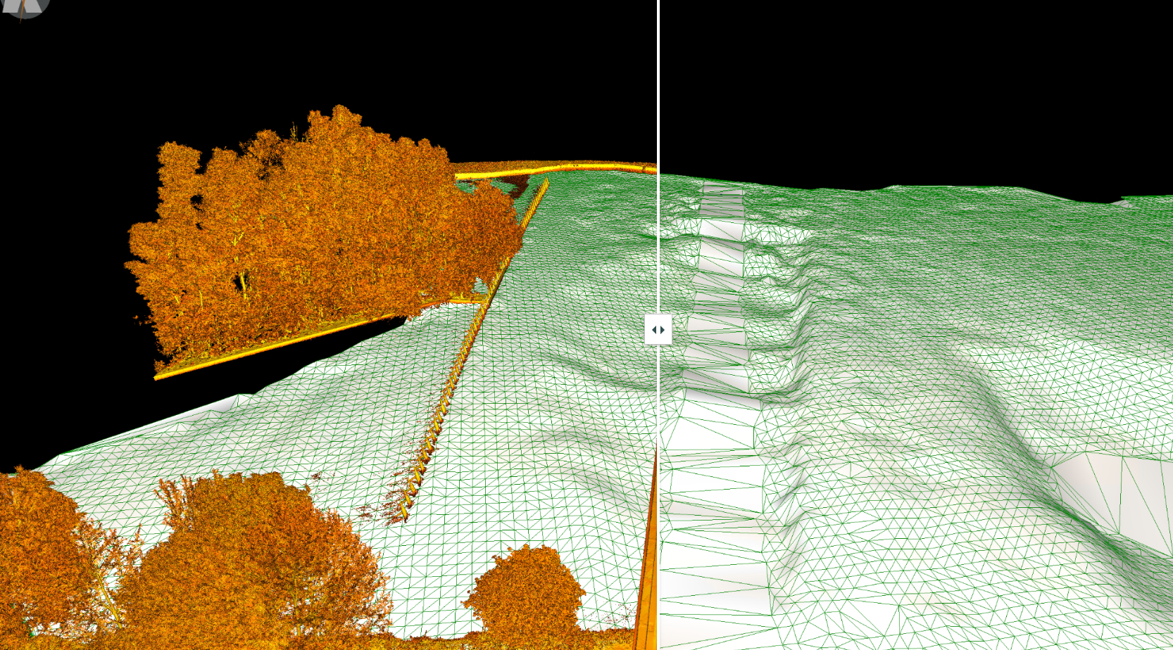
Kinematisches Modell vom Hallstatt ins Hochtal: Im kinematischen Modell wurde die Vegetation automatisch entfernt um die Topographie zu zeigen. Erstellt durch Riegl
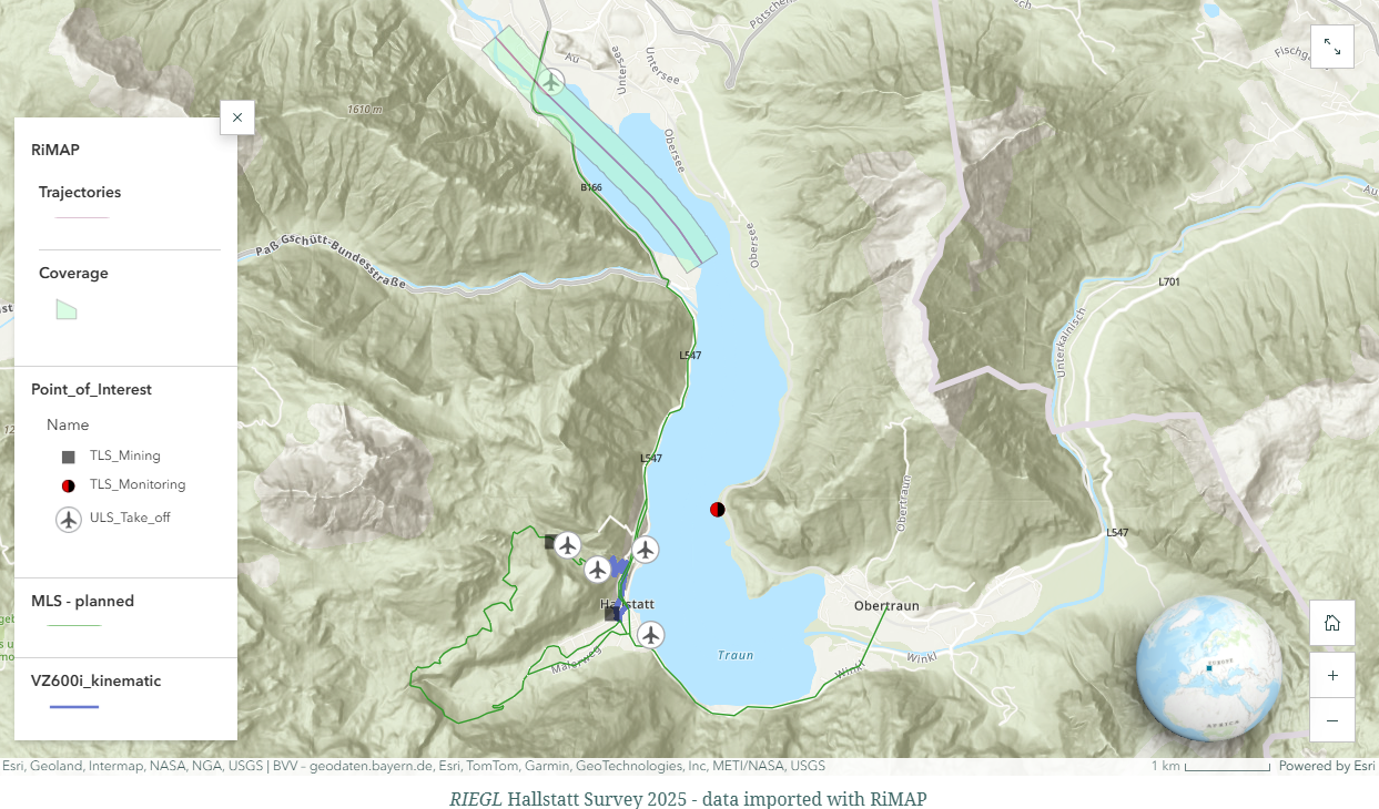
Punkte der Vermessung durch Riegl
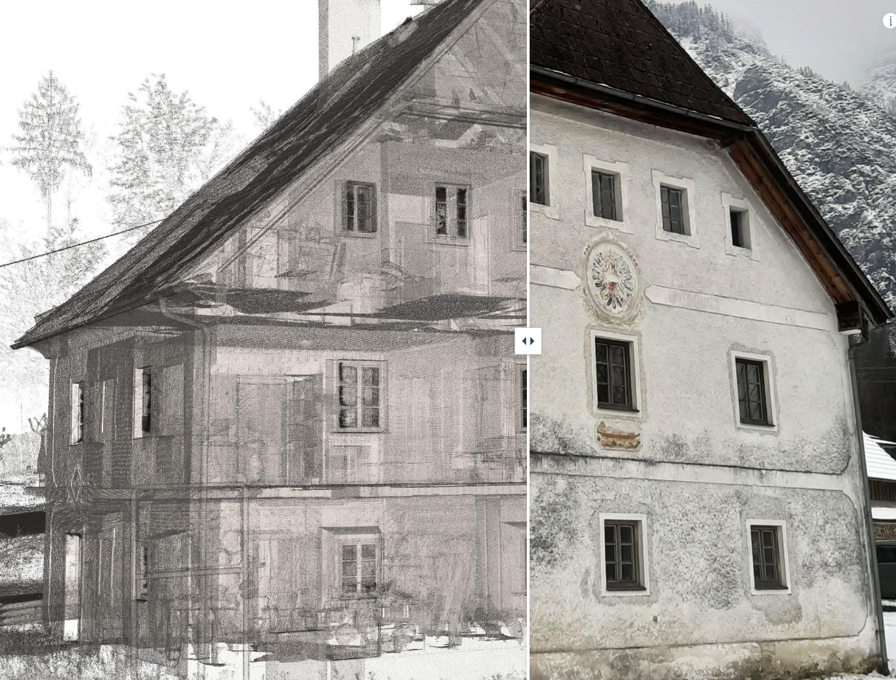
Streudiagramm der Punktwolke
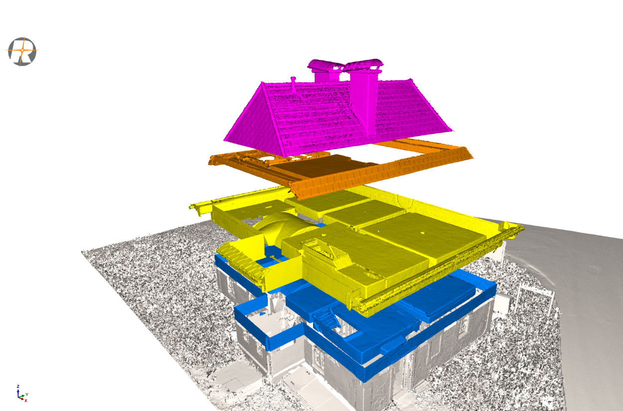
Georeferenzierte Punktwolke
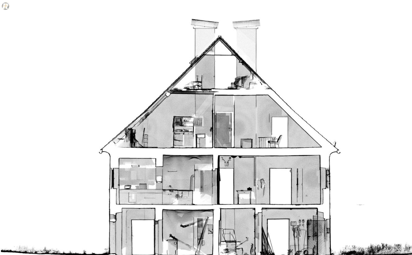
Georeferenzierte Punktwolke
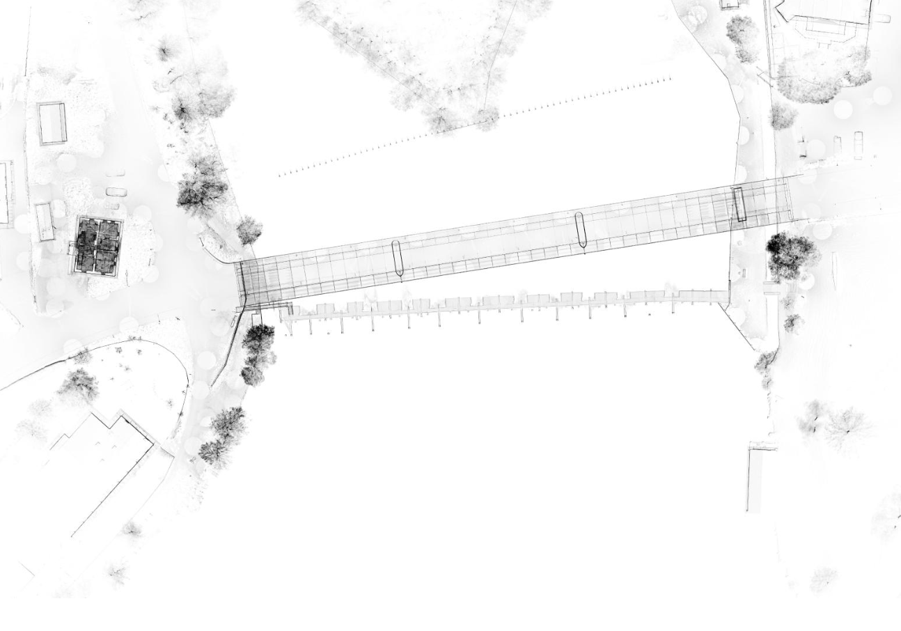
Georeferenzierte Punktwolke
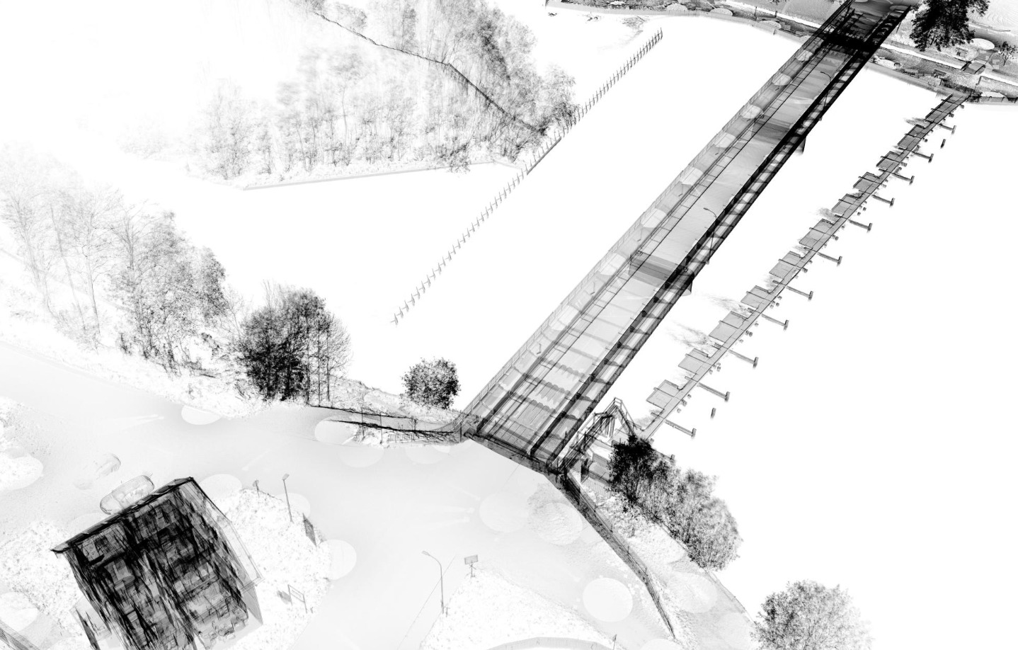
Georeferenzierte Punktwolke